
Archaeologist and Anthropologist Bill Angelbeck was scheduled to present his carbon-dating results, gathered from Signal Hill last year, at the annual Lil’wat Nation Land and Resources Department community supper.
Given that is not possible at this time, Bill’s update has been shared in the July Land and Resources Department newsletter, and we’re happy to share it here.
Archaeological Investigations at Spel’kumtn, Signal Hill by Bill Angelbeck
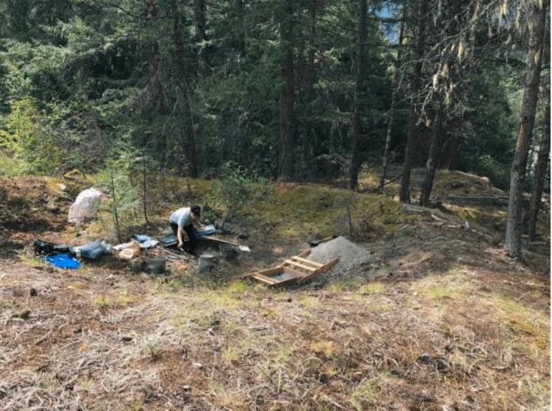
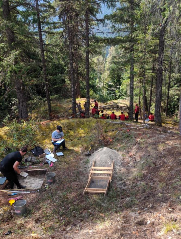
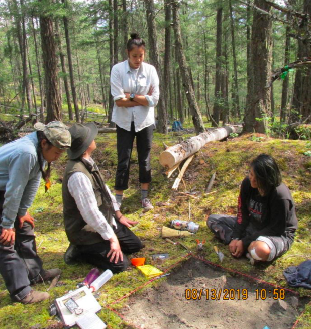
Last summer, our team conducted archaeological excavations at an ancient village site on Signal Hill, right near Pemberton.
The team would park not far south of the McDonald’s at the Junction of Highway 99 and Portage Road, and hike with our gear about a mile or so along the trail towards the Green River.
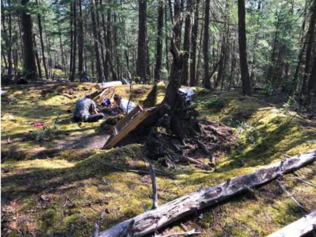
The village was situated on an high overlook with an astounding view of Mount Currie ascending sharply above, and the Green River flowing westward below the bluffs.
Two main routes led down from the village to the shores of the river, which reveals that it was well situated for a fishing camp.
Four substantial houses were here, and likely several other campsites with lighter shelters were present.
According to Lex Joseph and Johnny Jones, oral historical knowledge compiled in the Líl’wat archives indicates that the name of this place is Spel’kumtn, and it was associated with the Wolf clan.
This was also a place for lookouts.
Further up the trail from the village, leading up higher on Signal Hill, a scout would scan the landscape for travellers coming into the territory, sending plumes of smoke into the sky to alert others.
No doubt, this seems related to its current name as Signal Hill.
We had provided a summary of our excavations shortly after completion of fieldwork in a previous newsletter, almost a year ago.
Here, we provide some of the results from our analysis so far.
The village appears to have had two types of architecture, with a couple of earth-banked mat lodges, and a couple of pithouses.
Again, several other lighter shelters very likely were present, but the surface features are readily apparent for these four, as earth was moved to excavate a floor for an s7istken (pronounced roughly as “ishken”).
Mat lodges generally were above-ground shelters, often rectangular in outline but with sides leaning against the other, like an A-frame, with a log frame walled with woven mats.
Throughout the Interior, mat lodges typically were used in shoulder seasons of spring and fall, or at seasonal camps at which people would stay for several weeks.
Here, however, the lower sides were earth-banked, providing protection from the drafts beneath the mats.
Moreover, the floors of the houses were excavated slightly into the surface, which suggests that these mat lodges were still occupied into the late fall or even winter, with the earth banking providing greater protection from the winds.
From Líl’wat community members over a century ago by the ethnographer, James Teit (1906, page 213) recorded that “A few of the Upper Lillooet live in mat lodges in the winter-time. These generally had a double covering of mats; and all around the bottom, on the outside, bark was placed, against which earth was heaped to the height of from fifteen to fifty centimetres.”
Teit provided a photo of an earth-banked mat lodge, and the surface features of the remnant structures match the depiction of what would likely remain over the centuries since.
So, our excavations provide the first archaeological excavation of such a mat lodge in Líl’wat territory.
Last fall, we submitted five radiocarbon samples that we unearthed mainly from within the firepits of the houses or from structural beams.
Any old organic matter (firewood, roof beams, wood tools, animal bones, etc.) that was used or altered by the ancient inhabitants recovered from a site can be submitted to test how long it has been since the tree or plant was cut down and no longer absorbing Carbon-14 (C-14) radioactive isotopes (C-12 and C-13 isotopes remain stable, so we can determine the age by comparing how much of C-14 is left relative to the stable C-12 and C-13 amounts). Only a small amount of C-14 had dissipated, so the results indicate that these houses were inhabited 375 to 200 years ago. Some of the artifacts we uncovered do align with that date range as well, as there were a couple of post-contact trade items found in the houses, including a trade bead.
Johnny Jones and I would like to acknowledge the crew, most of whom have been a part of these excavations over the seasons, including:
- Oliver James
- Kristin Oliver
- Talon Pascal
- Kristi Bowie
- Alysha Edwards
- Jaime Yard
among others.
References
Duff, Wilson
1975 Images: Stone: B.C.: Thirty Centuries of Northwest Coast Indian Sculpture. University of Washington Press, Seattle.
Teit, James A
1906 The Lillooet Indians. The Jesup North Pacific Expedition. Memoir of the American Museum of Natural History, v. 2, pt. 5, New York.
