A community almanac from Pemberton, Lil'wat, Area C and N'Quatqua.
Acknowledge the ecological restorers
It is easier to destroy things, than to rebuild them. It sometimes seem to me as if destruction can happen at scale – machines get bigger, disasters get bigger, rapacious extractive systems get bigger. But the repair work has to happen one tiny stitch at a time. One seedling. One piece of plastic hand-removed.
Funny, how our technological prowess or progress seems to only accelerate on a destructive bent. As the meme goes, how come AI isn’t being trained to clean up garbage from the ocean, and instead, is going after the screenwriters’ jobs?
So I celebrate this effort, shared via Mt Meager Restoration, about the restoration project underway at the Capricorn Creek landslide to revegetate the debris zone, create conditions that will help plants and forest to return, and to ideally stabilize the banks and reduce downstream sedimentation.
Daunted as they may be by the scale of the task, they’re still showing up, and planting, and loving things, one seedling, one shady spot, one tadpole at a time.
Follow updates at their Facebook page, which is where, with permission, we’ve pulled this information from.
The intent of the project is to create conditions suitable for natural colonization.
Hail the ecological restorers. To all those who say, I’m going to stand with the living world.
Below, comes from Veronica Woodruff, one of our favourite guest contributors.
The Capricorn Creek landslide occurred in 2010 within Líl̓wat Nation Traditional Territory at Mount Meager Volcanic complex, located approximately 65 km northwest of Pemberton, BC.
Fifty million cubic meters of material shifted from the top of Capricorn Peak, traveled 3.7 km down the mountainous creek bed, and deposited in the valley below, inundating almost 9 km of Meager Creek and the Lillooet River.
Since the landslide occurred, natural vegetation regeneration in the ~3.5 km2 debris field has been sparse and limited to stable riparian banks, remnant stands that survived the inundation, and hummocky areas adjacent to live forested areas. Huge swaths of the debris field remain barren and devoid of vegetation.
The landslide material has drastically altered the sediment input into the lower reaches of the Lillooet River that runs through the Pemberton valley, significantly increasing the flood risk in populated areas and lowering the effectiveness of existing flood-protection infrastructure.
Updated floodplain mapping completed by Northwest Hydraulic Consultants in 2018 state that this slug of slow-moving sediment will continue to erode over the next 60–80 years (check out the PVDD or SLRD websites for links to this report).
Extensive effort has been expended to assess the effects of the landslide, including the sedimentation impacts on downstream fish and aquatic wildlife populations. The cost to manage the sediment downstream has triggered a massive investment by government agencies, including Líl̓wat Nation, Pemberton Valley Dyking District, Village of Pemberton, and Squamish-Lillooet Regional District. These downstream initiatives include gravel removal (e.g., bar scalping) and costly infrastructure upgrades (e.g., dike raising).
The goal of the restoration project proposed is to develop a revegetation plan to support accelerated natural regeneration throughout the landslide debris to improve habitat conditions and ideally reduce downstream sedimentation (though this is debate on whether this will be attainable). The intent of the project is to create conditions suitable for natural colonization.
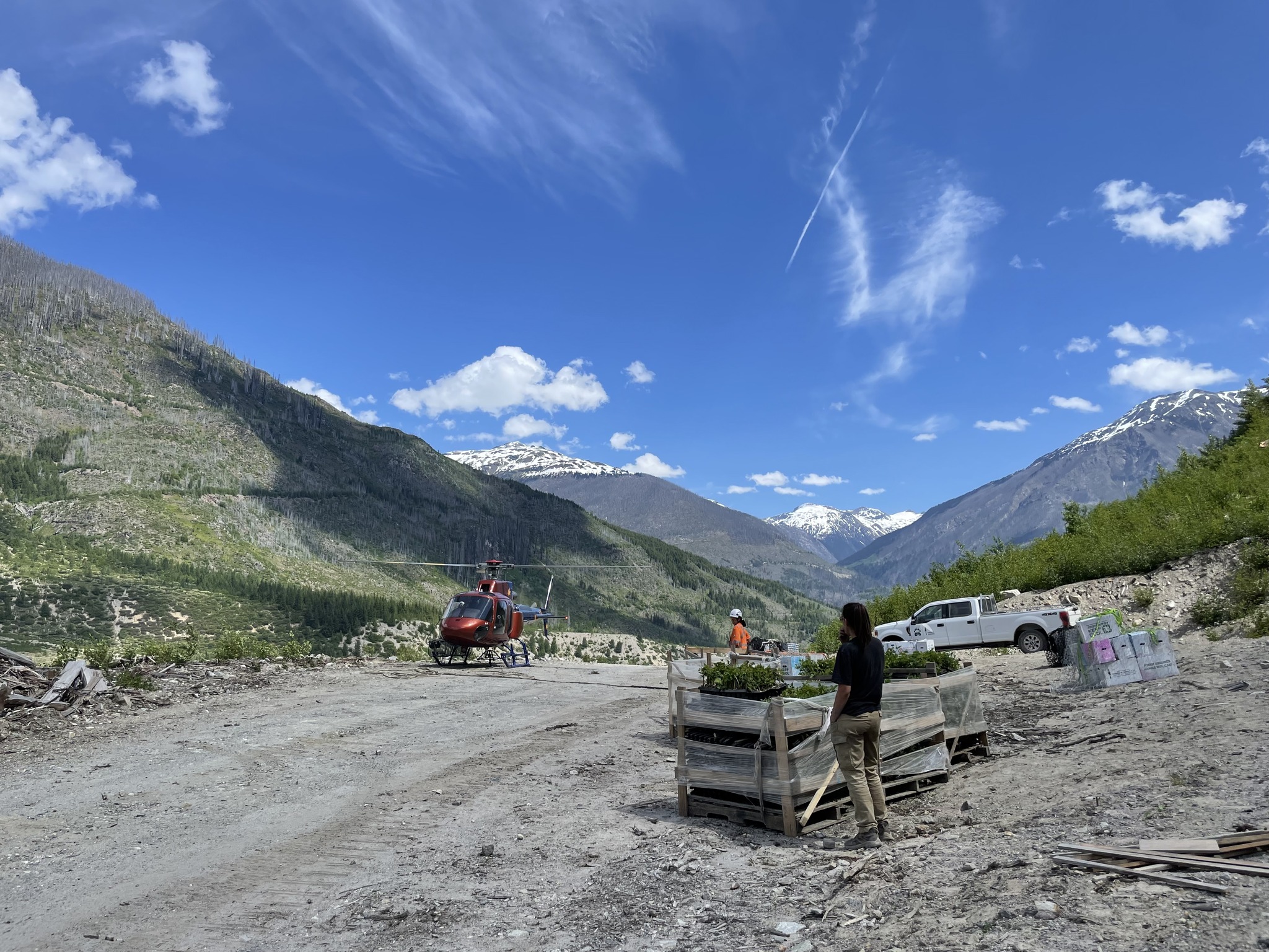
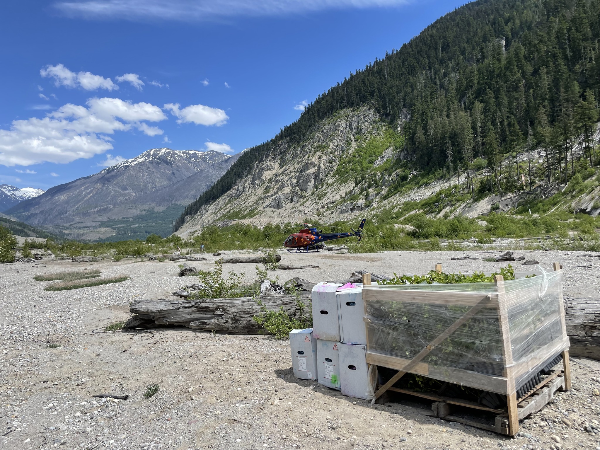
This spring, the first planting project will take place on a ~14-hectare site that has been determined suitable for planting immediately. This site is upstream of the confluence of the Capricorn and Meager drainages and has large wetlands and some natural regeneration.
Other sites within the landslide debris require some additional planning to ensure maximum stock survival. It is anticipated the planning will result in prescriptions using a range of potential treatments including:
• Planting areas using purchased or cultivated nursery stock or locally harvested stakes and seed.
• Integrating locally stockpiled topsoil and other organic materials into mineral soils to support growth.
• Building micro-site and macro-site structures, such as terraces, wattles, woody debris mounds, and other ground manipulations, to create conditions for planted stock success and to encourage natural regeneration through seed capture.
• Augmenting the soil with bryophytes, mycelium, and other natural growth-supporting strategies.
On June 5, the project shared that the Spring Plant 2023 is just about complete for a small 13 hectare site!
There were a number of planning variables that delayed planting this spring but our momentum carried us across the finish line. The weather couldn’t be worse for our poor plants, but we have selected a site that has quite a bit of moisture and we are hoping for moderate survival. We were lucky to access trees that were overstock from a fall plant at no cost. We focused on planting trees in areas with moisture like wetland and stream banks, shade-lines, and other suitable microsites to maximize survival. There is some natural regeneration at this site, mostly slide alder. Planting of these conifers and other berry species will increase habitat diversity and structure. There were lots of bear tracks and scat. We were joined by chorus frogs and thousands of western toads and their tadpoles. Hopefully these trees will help in shading the ponding water in the future to keep the thousands of tadpoles with water for long enough to metamorphose. Monitoring will continue to measure survival and determine future planting plans.
Info and photos courtesy Veronica Woodruff, Mt Meager Restoration Project